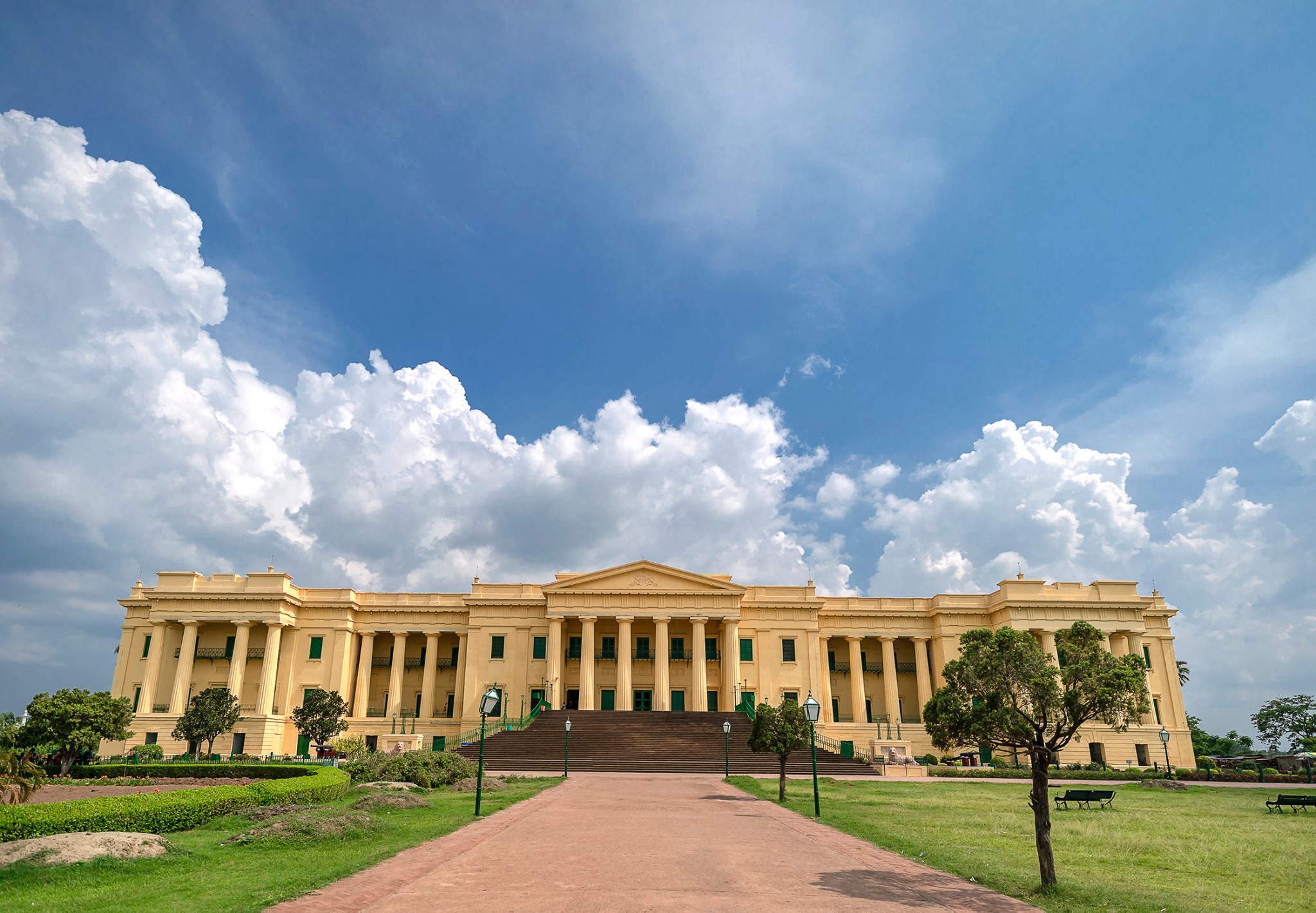
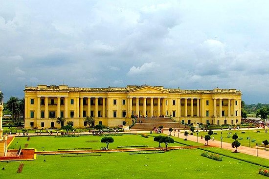
Hazarduari Palace & Museum
- Location- Long: 88°10’25” E, Latitude: 24°01’15” N
Locality-Lalbagh
Dis- Murshidabad
Gazette Notification No. BG, 80-Mis, Dated-14.01.1916
Brief Description
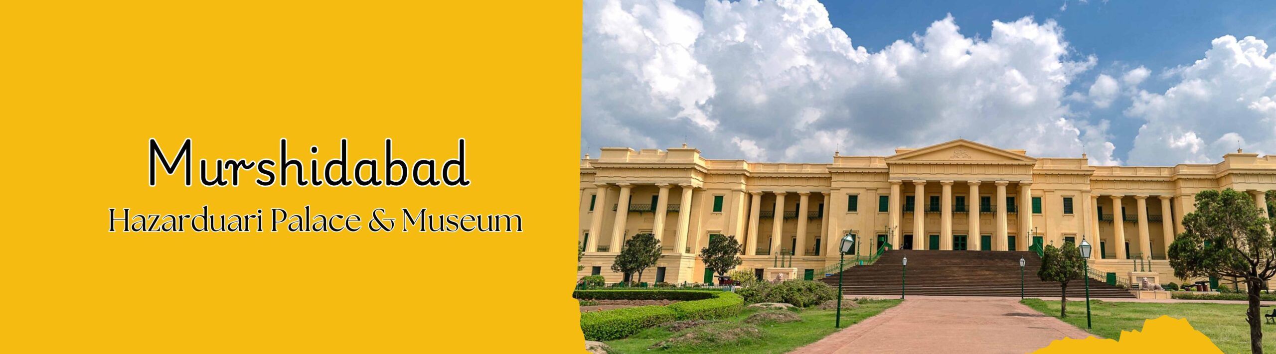
The Palace is popularly known as Hazarduari Palace as it contains about thousand real and false doors. It was built by Nawab Nazim Humayun Jah (1829-37 AD). The palace was used for holding Durbar and as residence of high ranking English Officials. Now it has been converted into a period museum. It has presently twenty galleries displaying a vast array of interesting exhibits which include life size paintings of the Nawabs of Murshidabad, British royal personages, period furniture, landscape paintings, silver thrones, palanquins, arms and armour used in various battles of this region, vases, ivory and marble objects etc.
The Imambara lying opposite to the palace is a vast building with a Madina at the centre.
Photo Gallery

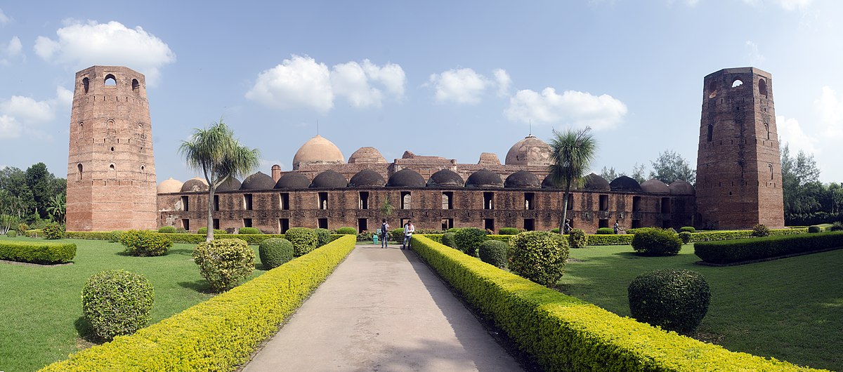
The Tank and Mosque of Murshid Kuli Khan
- Location- Lat. 24⁰ 11’ 05” N.
- Long. 88⁰ 17’ 17” E
- Locality- Sabjikatara
- Dis-Murshidabad
- Gazette no. BG, 1769, 18.4.1914
Brief Description
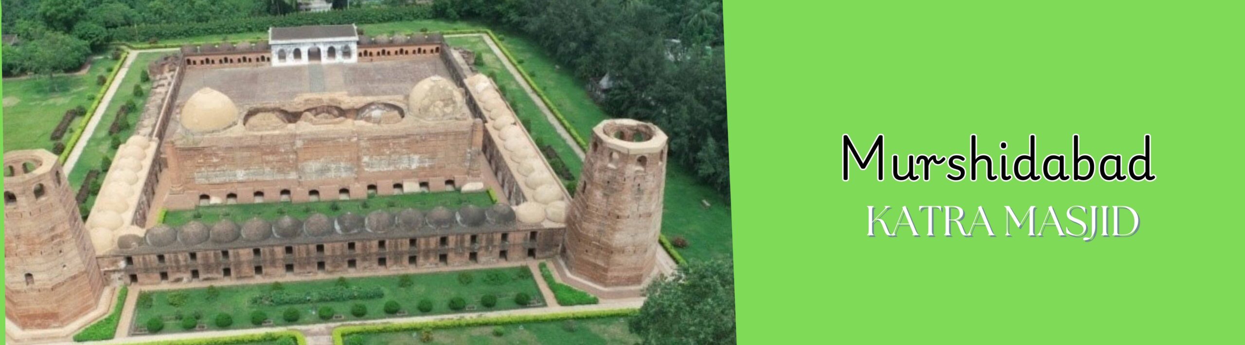
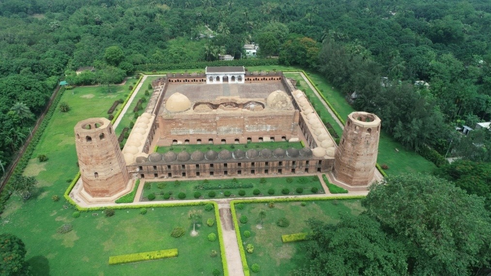
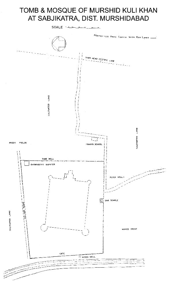
The mosque was constructed in 1724-25 by Murshid Kuli Khan according to an inscription over the east façade. Murshida Kuli khan officially transferred the capital of Bengal from Dhaka to Murshidabad in 1717, a city he named in honor of himself. This mosque also contains the grave of Murshid Kuli Khan under the staircase. It had five domes but now two are survived. The two-storey domed cells round the mosque and the terrace, which accommodated seven hundred karis or Koran readers. The most striking feature of this mosque is four huge minarets at each of the corner but today two are extant. The only other thing which in this mosque, as in other old Musjids, has escaped the ravages of time or at least has not been materially affected, is the inscription, the crispness of which, being on basalt, has withstood with all freshness. The slab, which is on the middle door way, is rendered thus: – “The triumph of Mahomed of Arabia is the glory of heaven and earth. Let the dust of his feet fall on the head of him who is not the dust of his door”.This latter portion is also rendered this: – “He who is not the dust of his door, dust on his head.”
Photo Gallery
The Tripolia Gate
- Location- Longitude- Lat. 24⁰ 11’ 09” N.
- Long. 88⁰ 16’ 16” E
- Locality- Lalbagh
- Dis-Murshidabad
- Gazette no. S.O. 556 (E) dated 14.05.2003
Brief Description
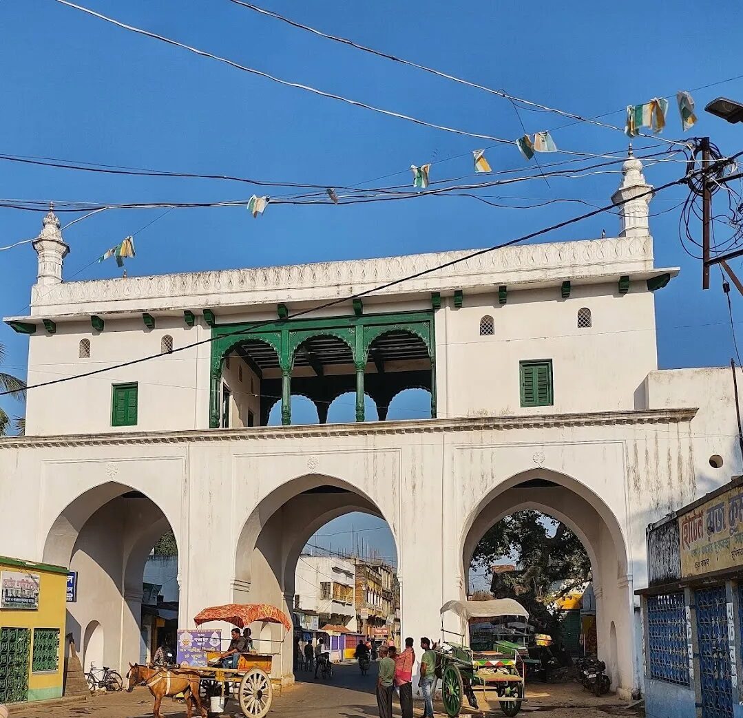
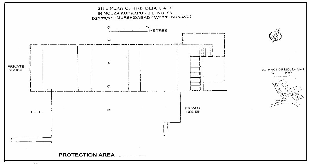
This massive gate, with three arch-ways, situated to the east, was built by Nawab Shuja Khan. It is surmounted by a Nowbutkhana and is known as the Chowk Gate of the Killah.
Photo Gallery
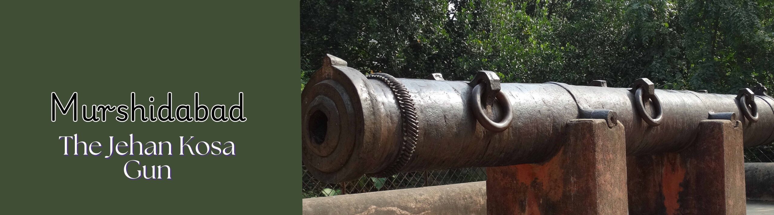
The Jehan Kosa Gun
- Location-
- Longitude- Lat. 24⁰ 10’ 53” N.
- Long. 88⁰ 17’ 17” E
- Locality- Lalbagh
- Dis-Murshidabad
- Gazette no.: 9195 P dated the 11th September, 1925
Brief Description
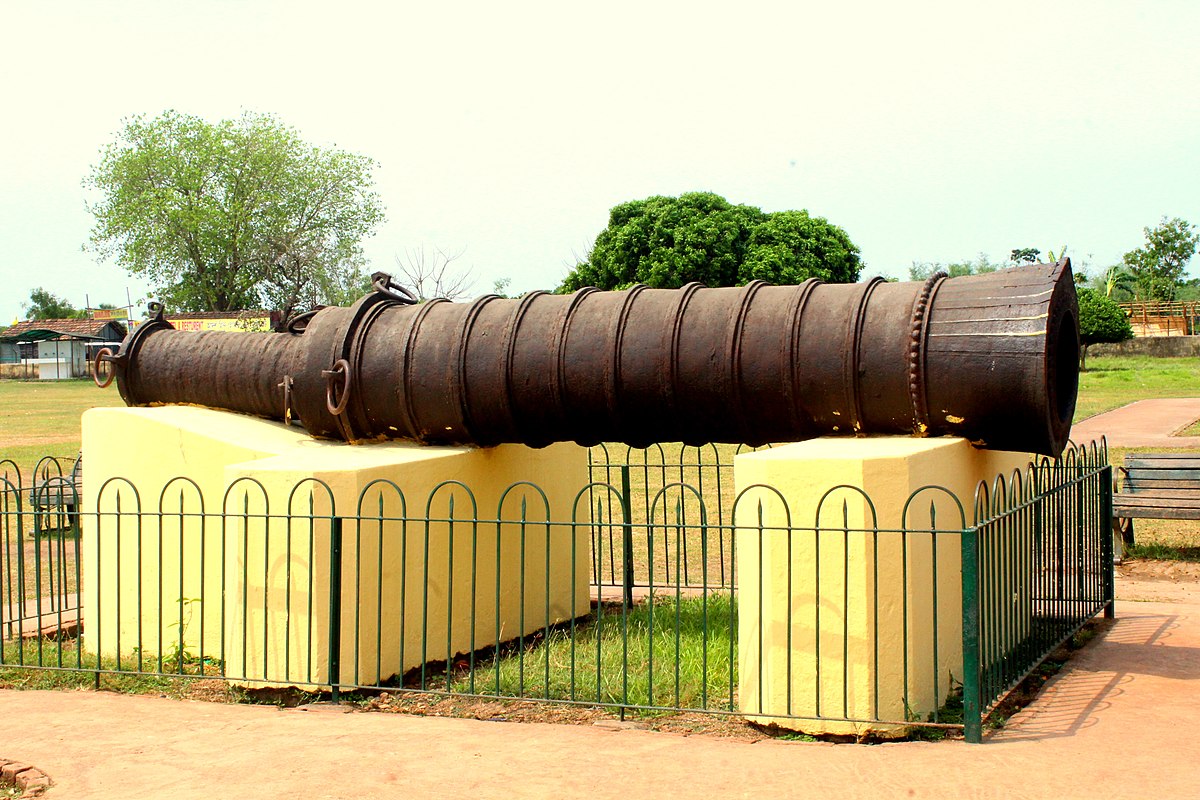
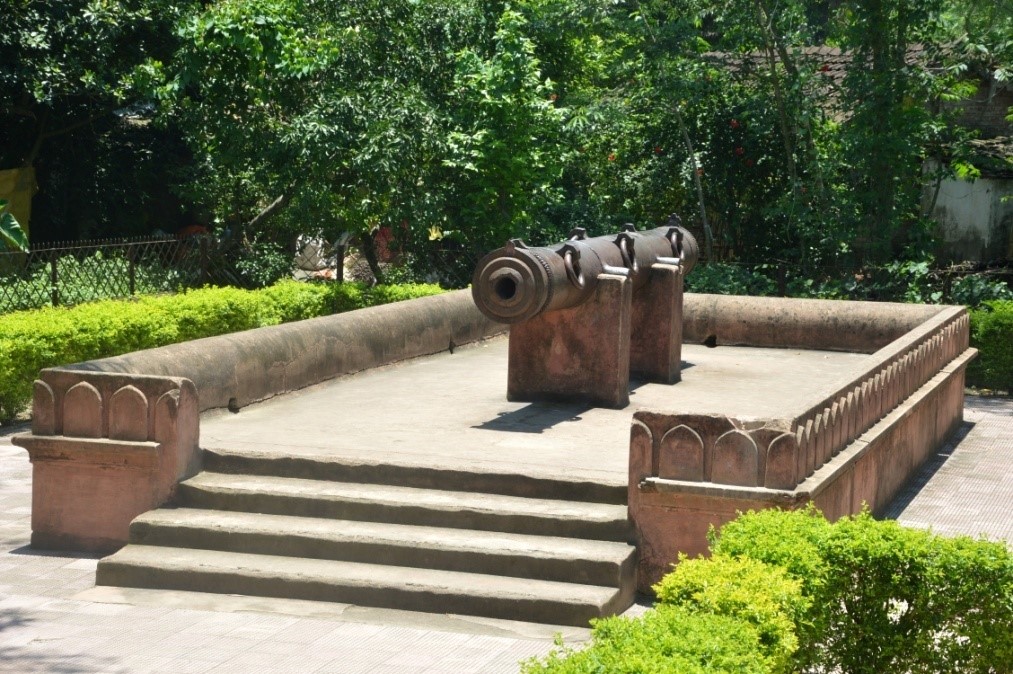
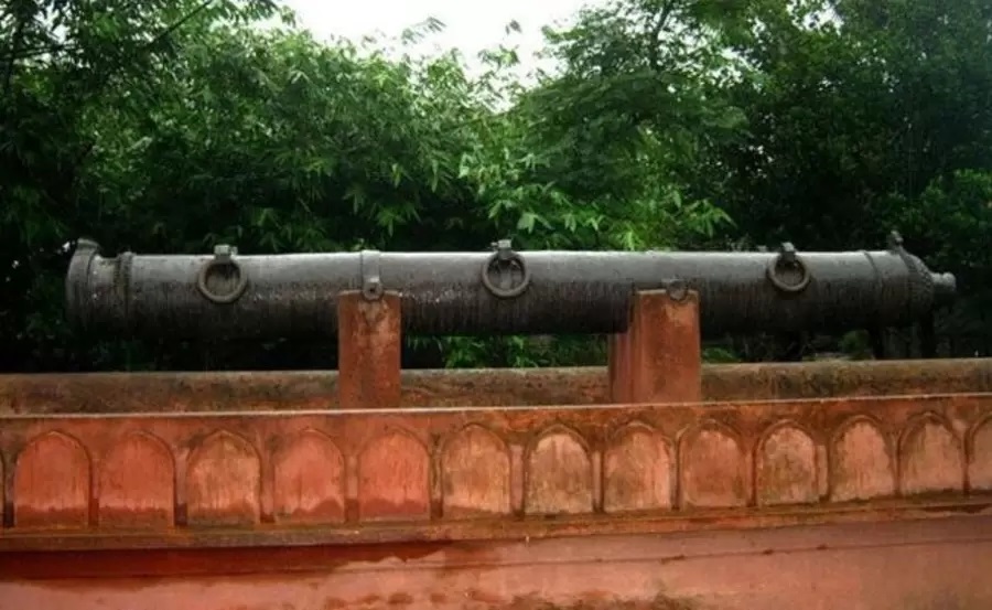
A quarter of a mile to the south east of Katra is Tope Khana, the site of the Nawab’s Artillery Park. Here lies a great gun, called Jahan Kosha, destroyer of the world with originally rested on a carriage with wheels. The gun is made of a composition of eight metals namely gold, silver, copper, lead, zinc, mercury, iron and tin. It is 17 feet and 6 inch long, with girth of 5 feet at the touch hole end. The diameter of the tough hole is one and a half inches. The weight of the gun is 212 mounds and the powder required for the charge is 28 seers. The gun was made at Dacca during the reign of Sha Jehan, when Islam Khan was the Subedar of Bengal, by Janardan Karmokar, under the instructions of Darogah Shere Mahomed and the supervision of Hara Ballav Das, in 1637. The gun was an object of veneration by the lower classes of the people, who put oil and red mercury on it and offer presents of flowers, milk and sweets.On the gun are plated nine brass tablets with inscriptions, many of which cannot now be deciphered.
Photo Gallery
The tomb and the mosque of Aliverdi Khan and the tomb of Seraj-ud-Dowla
- Location-
- Longitude- Lat. 24⁰ 09’ 39” N.
- Long. 88⁰ 15’ 33” E
- Locality- Khosbagh
- Dis-Murshidabad
- Gazette no. 633, Dated 08.02.1915
Brief Description
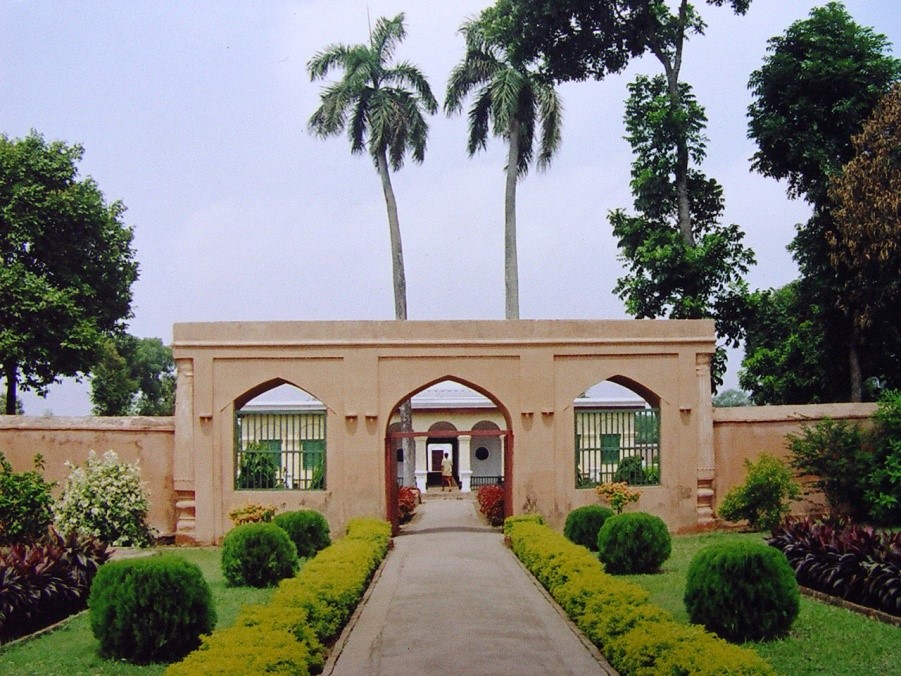
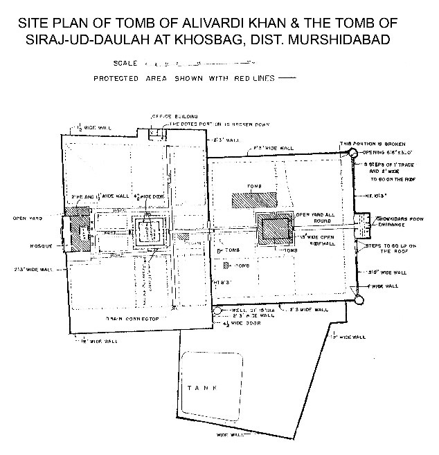
Crossing over to the other side of the river, opposite site Amaniganj, is khoshbagh, a garden containing the cemetery of Ali Verdi Khan and his family. It consists of walled enclosures and outer wall enclosure. In the middle of the enclosures is the mausoleum, containing the tombs of Ali Verdi Khan, Serajud-dowla and principal member of their family. Ali Verdi Khan’s mother and Serajuddowla’s wife Lutfunnissa Begum, also lie buried here. The grand- father and the grand-son lie side by side. The Central and larger tomb is that of Ali Verdi Khan, while that to the east of it is the tomb of Serajuddowla.
In the outer enclosures there are numerous tombs with nothing to identify them. Ali Verdi Khan endowed the villages of Bhandardaha and Nawabganj, with a revenue collection of Rs. 305 per month, for the maintenance of mausoleum. In the compound, there is a large mosque with a terrace in front.
Photo Gallery
Tomb of Suja-uddin
- Location-
- Longitude- Lat. 24⁰ 11’ 15” N.
- Long. 88⁰ 15’ 51” E
- Locality- Roshnibagh
- Dis-Murshidabad
- Gazette no.- 1546 Mis dated the 29th December, 1920
Brief Description
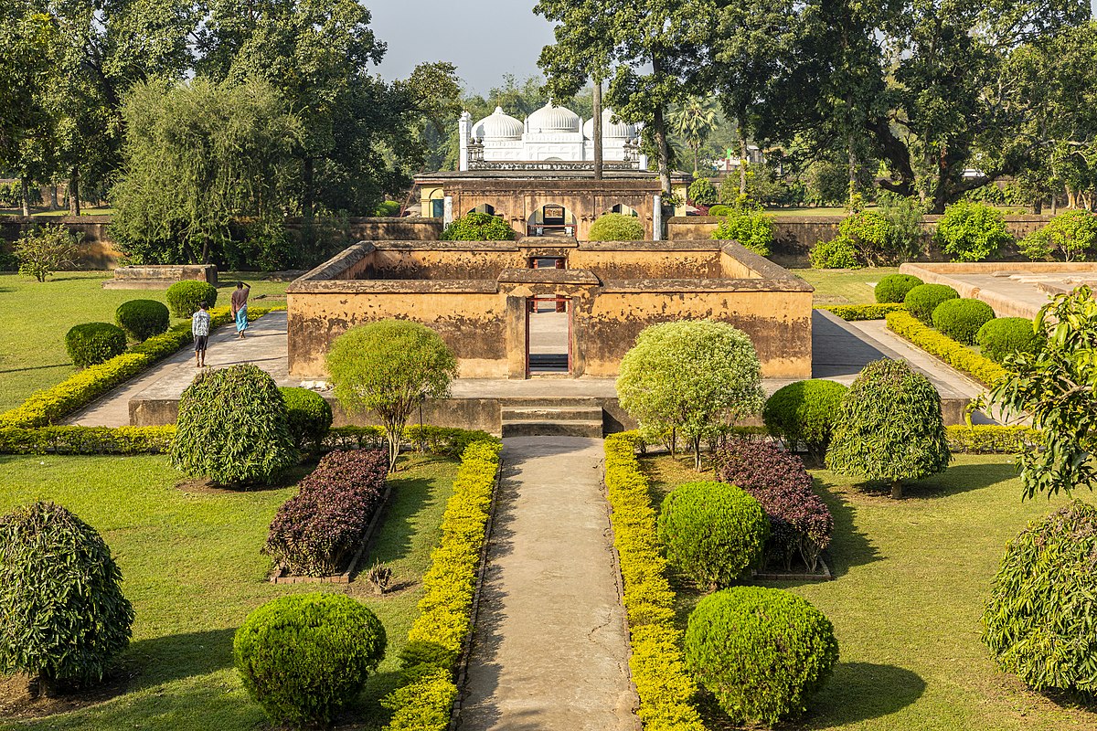
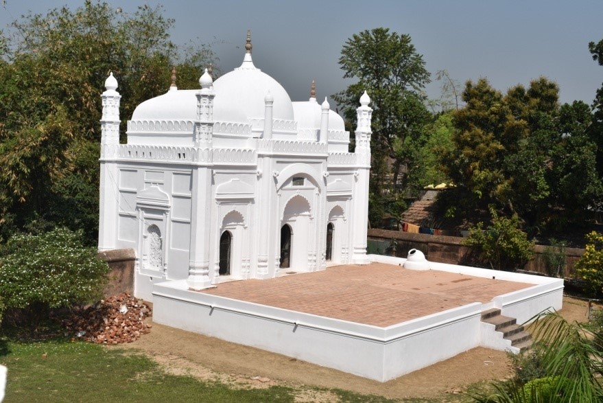
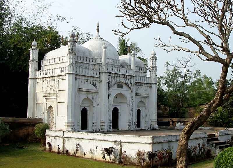
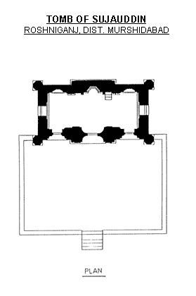
On the western bank of the river opposite the Hazarduari Palace, is Roshnibagh, or the garden of light, the mausoleum of Shuja Khan, who died in 1739, after having erected his mausoleum and mosque. A very beautiful Koran, which claims to be in the handwriting of Ali and was procured at a cost of one lac of rupees, used to be kept in the mosque. The Persian distich on the slab of the mosque shows date 1156 H. On the banks of the river, near Roshni Bagh, a bamboo structure used to be constructed for purposes of illumination on the occasion of the Bera. The slab on the walls of the building containing the tomb reds thus; – Ze Zilhej saddah roze e se shamba sal e rehlat dan Ke Ferdousi burin Jai e Shujauddowla ja ve dan.
In the outer enclosures there are numerous tombs with nothing to identify them. Ali Verdi Khan endowed the villages of Bhandardaha and Nawabganj, with a revenue collection of Rs. 305 per month, for the maintenance of mausoleum. In the compound, there is a large mosque with a terrace in front.
Photo Gallery
OLD ENGLISH CEMETERY OR OLD RESIDENCY BURIAL GROUND
- Location-
- Longitude- Lat. 24⁰ 07’ 29” N.
- Long. 88⁰ 16’ 11” E
Locality- Kasimbazar
Dis-Murshidabad
Gazette no. – 4123 dt. 12.11.1915
Brief Description
The cemetery belonged to the early English residents of Cossimbazar and contains the toms of several persons who died between 1735 and 1800. Mrs. Hastings lies buried here. The monuments over her grave bears the following inscription; –
In memory of Mrs. Warren Hastings, and her daughter, Elizabeth, who died 11th July, 1759 in the 2 years of her age. This monument was erected by her husband Warren Hastings, Esquire, in due regard of her memory. Restored by Government of Bengal, 1863.
The cemetery contains the tombs, among others, of the following persons; –
Anstruther (1735), Rose Grant (1775), A. Downie (1781), Captain Hartie (1782), Captain Clerk (1783), Campbell (1784), Charles Crommelin (1788), John Peach (1790).
Photo Gallery
RESIDENCY CEMETERY ALSO KNOWN AS STATION BURIAL GROUND
- Location-
- Longitude- 88°09’51” E,
- Latitude: 25°09’9″ N
- Locality- Babulbona
- Dis-Murshidabad
- Gazette no- 4124 dt. 12.11.1915
Brief Description
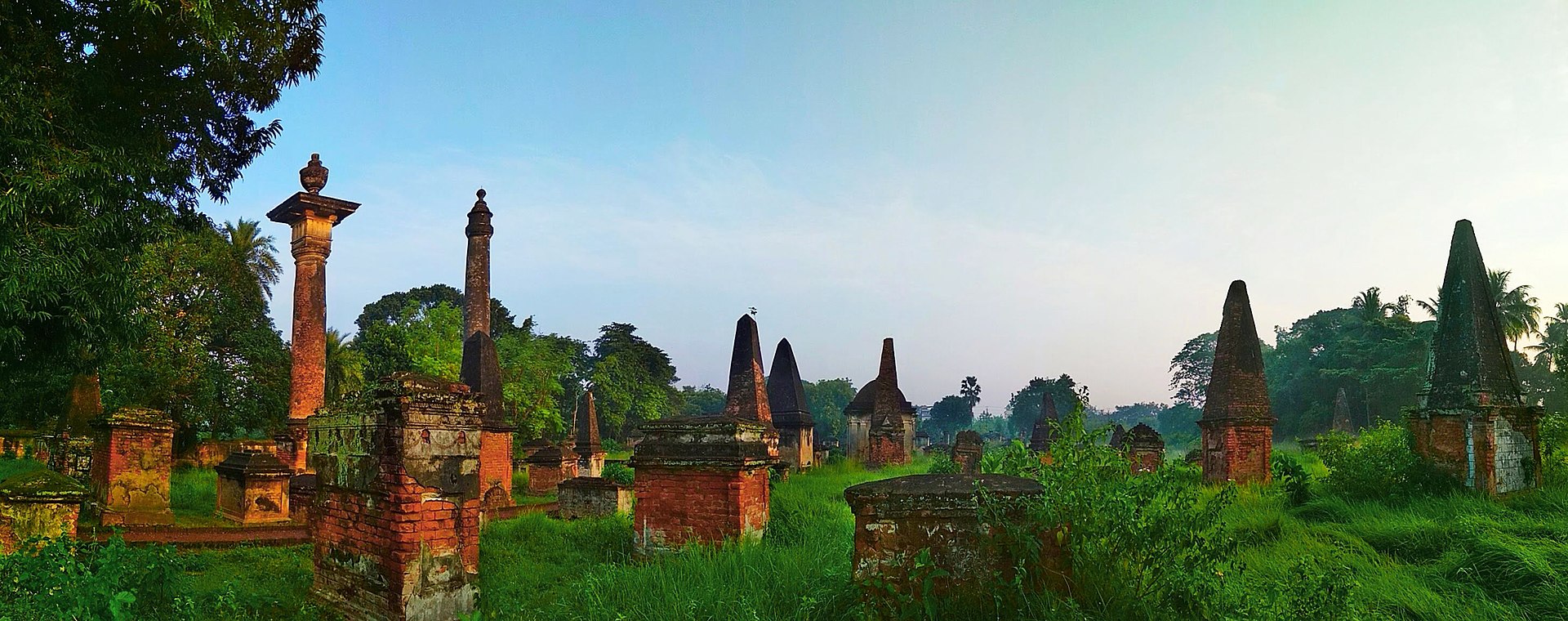
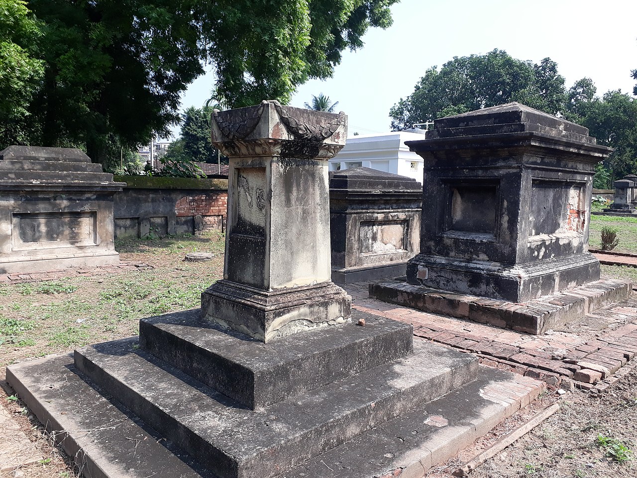
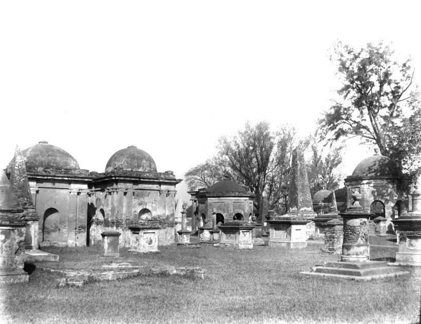
One of the most interesting Spots in Behrampur in the Old Cemetery at Babulbona, a mile to north-east of the barracks, which contains several interesting monuments of the end of the 18th and beginning of the 19th century. The oldest inscriptions are in memory of Captain James skinner who died in 1773. Here also was buried George Thomas, one of the most famous of European adventures in India
Photo Gallery
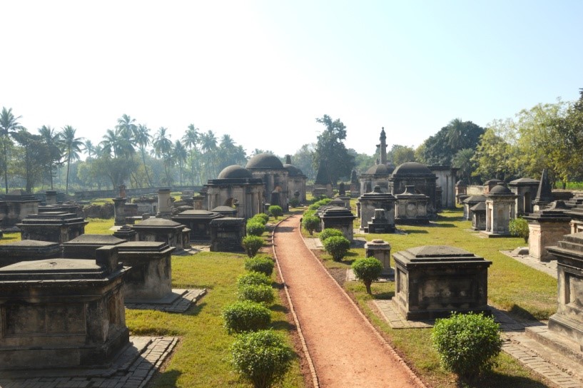
Dutch Cemetery
- Location- (Lat. 24⁰ 07’ 24” N.
- Long. 88⁰ 15’ 59” E)
- Locality- Kalikapur
Dis-Murshidabad - Gazette no- 496 misc dated the 22nd March, 1916
Brief Description
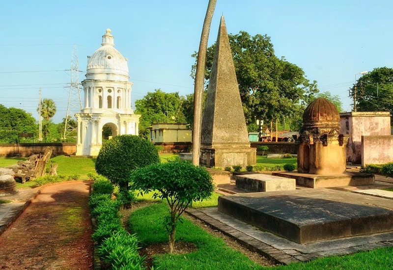
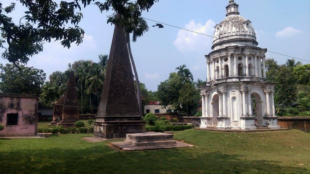
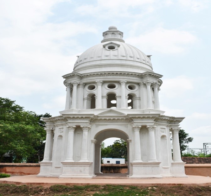
A little to the west of the Residency Cemetery is Dutch Cemetery at Kalkapur, where the Dutch factory Stood. Bernier mentions it as in existence in 1666, and says that it employed as many as 7 hundred or 8 hundred men. Teifanthalar also describes those Dutch buildings as being vast and magnificent. A French man Jorge Louise Berne, who was a friend of Waren Hastings, was second in command herein 1756 and showed great kindness to the English after the capture Cossim Bazar and Kolkata by Nawab Siraj-ud-dowlah. Nothing was then late but the Dutch cemetery, which contain 47 monuments, the oldest being that of Daniel Van Der Miyl who died in 1721 AD. It bears no inscriptions and it is a tall structure to pair of pillars supporting a cupola.
Photo Gallery
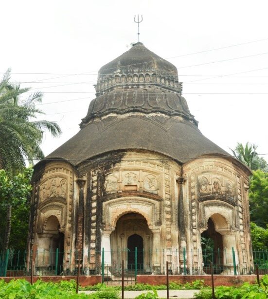
Bhavaniswar Temple
Location- Lat. 24⁰ 15’ 08” N.
Long. 88⁰ 14’ 35” E
Locality- Baranagar
Dis-Murshidabad
Gazette no. Edlands, F.4-20(5)/41-F & L, 10.6.1942
Brief Description
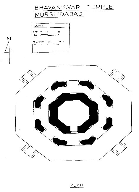
Tallest lime and mortar temple at Baronagar, built in 1755 AD by Rani Bhavani’s daughter Tarasundari. Inverted lotus-like dome of this 18 M tall temple and a circular corridor around the inner sanctum are note-worthy features. Human figures on the outer facade are average. The floral motifs on the outer wall of inner sanctum are excellent. The tall lime and mortar Bhavaniswar temple are remarkable for two reasons. The roof of this octagonal temple looks like an inverted lotus and it has a corridor, decorated with large floral motifs, around the inner sanctum.
Photo Gallery
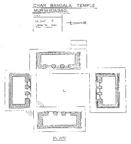
Char Bangla Group of Four Shiva Temple
Location- (Lat. 24⁰ 15’ 05” N.
Long. 88⁰ 14’ 38” E)
Locality- Baranagar
Dis-Murshidabad
Gazette no.: Edlands, F.4-20(5)/41-F & L, 10.6.1942
Brief Description
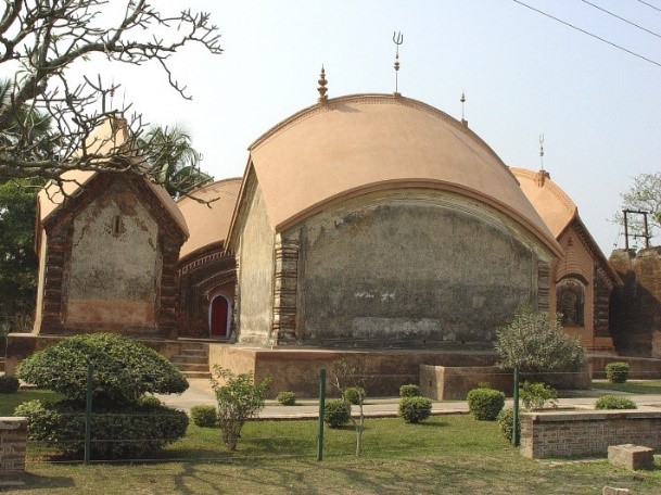
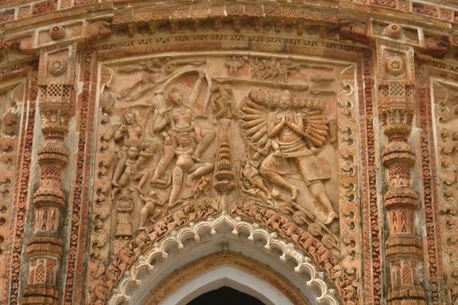
The “Char Bangla” temples in the Murshidabad district of West Bengal were built by Queen Bhavani of Natore in 1755 CE. Each of the four terracotta temples was built in the style of the traditional village huts of Bengal with two sloping roofs, called “Do-Chala” or “Ek Bangla” temples and has three arched openings and 3 Shiva-Linga’s inside each temple. Their facades are ornamented with terracotta panels, depicting scenes from the daily life and Puranic legends. Three temples with the exception of the northern temple share a platform which is about 1.5 feet high. The northern temple stands on a separate platform. The northern and western temple facades have richly decorated terracotta work. The eastern temple has beautiful lime and mortar relief work with the large scene of the Kurukshetra taking centre stage above one of the arches. The fourth temple has simple terracotta motifs on its walls. The northern temple has panels depicting scenes from the Puranas, Ramayana, Mahabharata, Krishna Leela, different forms of Ma Shakti, social and rural life, damsels, musicians, dancers and others. One of the most remarkable panels is Lord Shiva sitting with Nandi with Bhringi serving him. The central arch in the western temple shows Lord Rama sitting on the shoulders of Lord Hanuman battling the ten-headed Ravana. The expressions and detailing that has gone into each part of this panel titled ‘Last Prayer of Ravana’ is spectacular. Lord Krishna and Radha scenes from the Srimad Bhagavata Purana narrating the life of Lord Krishna and Durga Devi slaying demons are lifelike.
Photo Gallery
Mound Known as Devil’s Mound and Raja Karna Palace
Location- Lat. 24⁰ 01’ 45” N.
Long. 88⁰ 11’ 27” E
Locality- Chiruti
Dis-Murshidabad
Gazette no. 1546 Mis, 29.12.1920
Brief Description
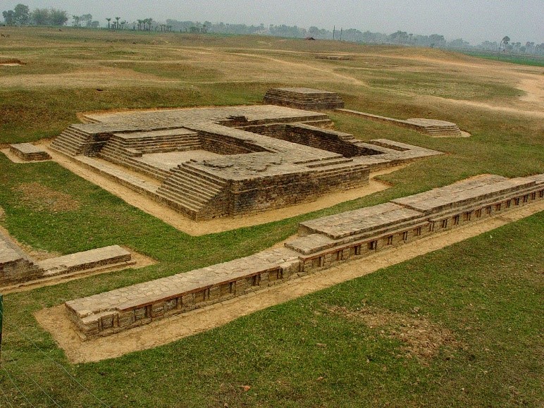
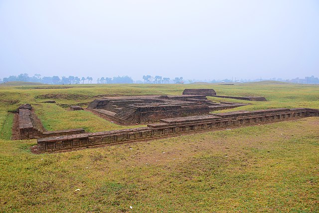
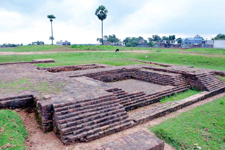
The ruins of Karnasubarna, ancient capital of Gauda kingdom is situated at 9.6 km in south-west of Berhampore. Karnasubarna was famous as a prosperous politico-administrative, military and religious urban centre. Its fame was however short lived. It came into prominence with the rise of Shashanka in the early part of 7th Century AD and passed into oblivion by the end of the of that very century. Hiuen Tsang visited this site during the reign of Harshavardhana, the king of Thaneshwar, which is referred in his biography Da Tang Xiyu Ji. According to this book, he moved from Tamralipti to the country of Karnasubarna and saw an existence of Monastery know as a Rakt-Mrittika Mahavihara.
With a view to identifying Karnasubarna, the traditional capital city of Shashanka with its Stupas, monasteries and other monuments mentioned by Hiuen Tsang, the department of Archaeology, university of Calcutta, under S. R Das conducted excavation at Rajbari Danga in 1962-63. The excavation revealed five phases of structure. Various archaeological remains viz. terracotta sealings, figurines have been recovered from this site which ranging from 3th -4th and to 6th -7th Century. The most significant clue to the identification is a sealing which was occurred from the III phase bears the Dharmachakra Deer symbol on its upper part and two lines of inscription on the lower part. Line I: Shri-Rakta(M)rittika-(ma)havihara and Line II: rik-arya-bhikshu-(Sanga)s(y)a.
Beautiful stucco mouldings, terracotta lamps, two stucco heads belonging to Gupta period and a copper Chakra of 8th century AD, terracotta figurines, including those of a votive nature and a female deity were recovered from this site.
Photo Gallery
Motijheel Mosque
Location- (Lat. 24⁰ 09’ 42” N.
Long. 88⁰ 16’ 33” E)
Locality- Motijheel
Dis-Murshidabad
Gazette no- S.O. 1136(E) dated the 30 April, 2009
Brief Description
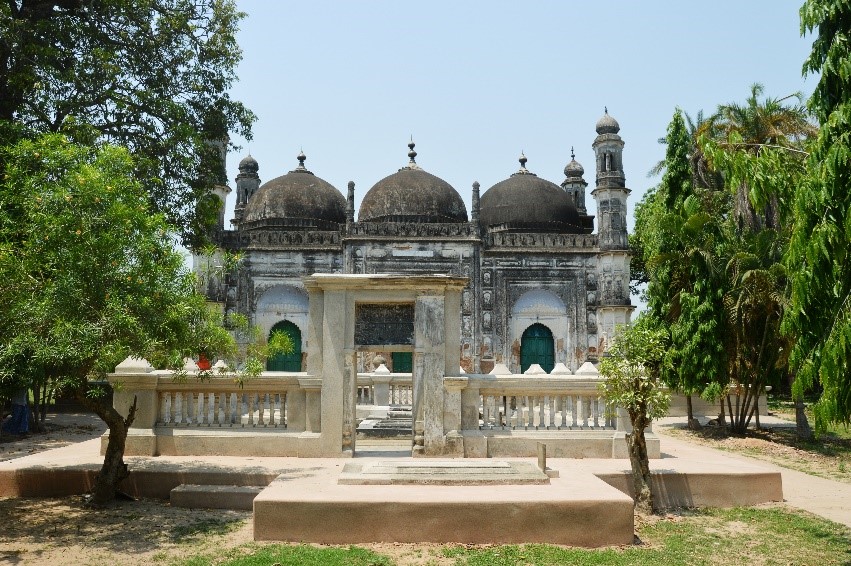
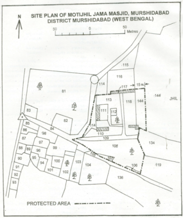
The Triple dome mosque has three arched façades. The flanking one are blind. As per reference, Nawab Alaverdi Khan used to come regularly to the mosque to offer prayer. His eldest daughter Ghasati Begum adopted Ekramulla, the younger brother of Siraj-ud-Daula, as her son. When Ekramulla died at a young age, Nawaej Muhammd Khan, the husband of Ghasati Begum could not bear the shock and died shortly afterwards, both of them were buried side by side in the precinct of the mosque. Motijheel Mosque, which stands adjacent to the western bank of the Motijheel, was built by Nawab Nawaej Muhammad Khan in 1750 AD. He named it as Kala Masjid, which now well known as Motijheel Mosque.
Photo Gallery
IMAMBARA
Location- Lat. 24⁰ 11’ 11” N.
Long. 88⁰ 16’ 07” E
Locality- Lalbagh
Dis-Murshidabad
Gazette no. SO 553(E) dated 14.05.2003
Brief Description
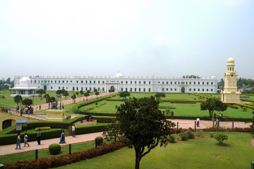
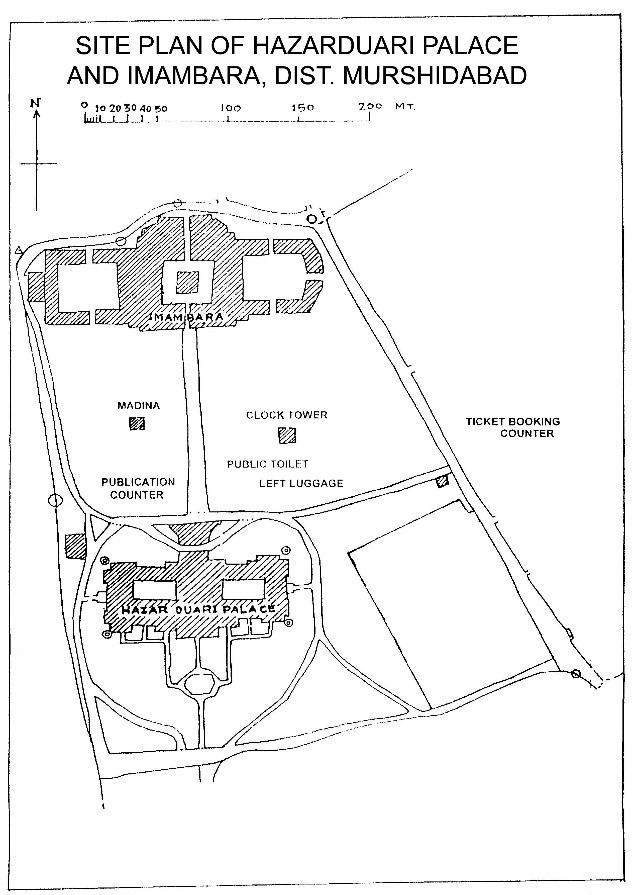
The enormous Imambara was built in 1847 by Nawab Feredun Jah at a cost of six Lakhs after an earlier Imambara of Siraj-ud-Daula had been destroyed by fire. It took only 11 months in construction under the supervision and direction of Sadiq Ali Khan. The two -storied Imambara, which is the largest one in India, is divided into three large Quadrangles. In the central part single domed medina is situated. The style of both the Imambara and the Medina is influenced by European Architecture.
Photo Gallery
South Gate
- Location- Lat. 24⁰ 10’ 49” N.
Long. 88⁰ 16’ 11” E
Locality- Lalbagh
Dis-Murshidabad
Gazette no. S.O. 552 (E) dated 14.05.2003
Brief Description
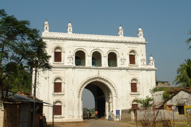
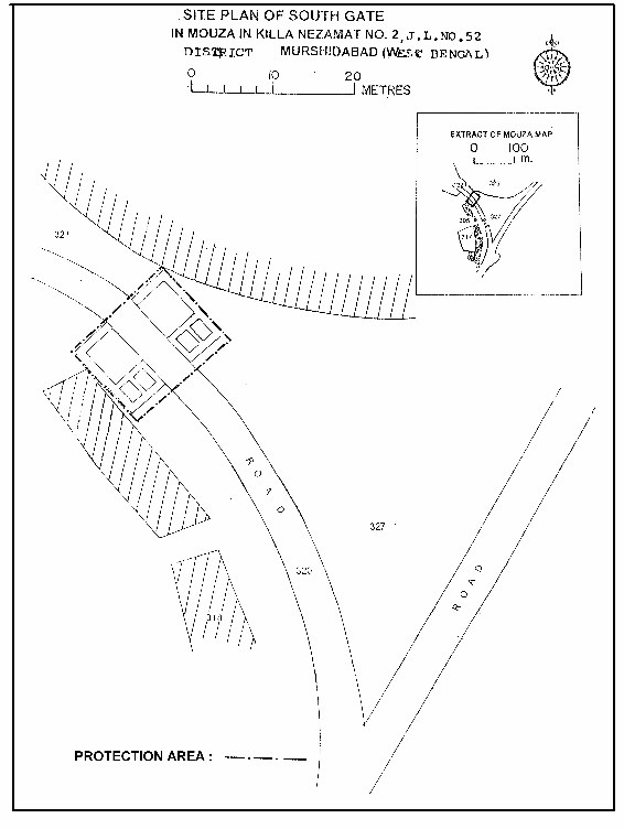
This massive gate is the entrance gateway to the Killa Nizamat situated at the south side. It was built probably the period of Nawab Walah Jah in the Year 1821-24 CE. This gate is called Dakshin Darwaja and is surmounted by a Nawbat Khana where Royal instruments were played. The entrance is large & high enough for an elephant to pass with howdah on its back.
Photo Gallery
The Tomb of Mirmadan
- Location: (Lat. 24⁰ 04’ 46” N.
Long. 88⁰ 14’ 32” E)
Locality- Faridpur
Dis- Murshidabad
Gazette Notification No- B.G. 637, 8.2.1915
Brief Description
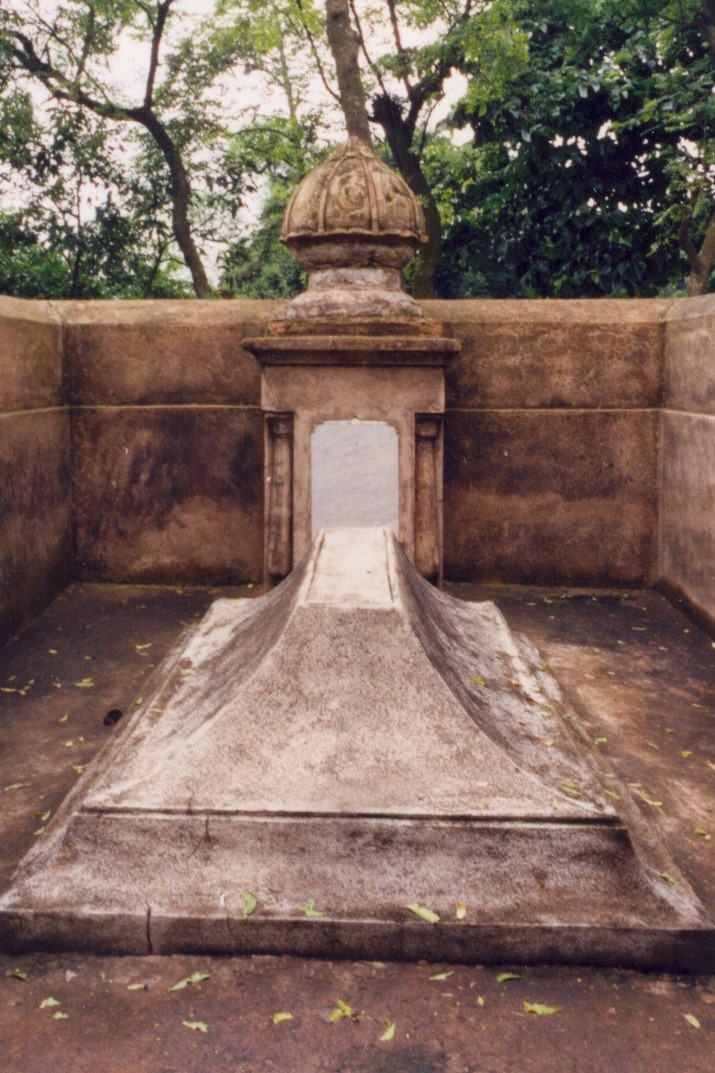
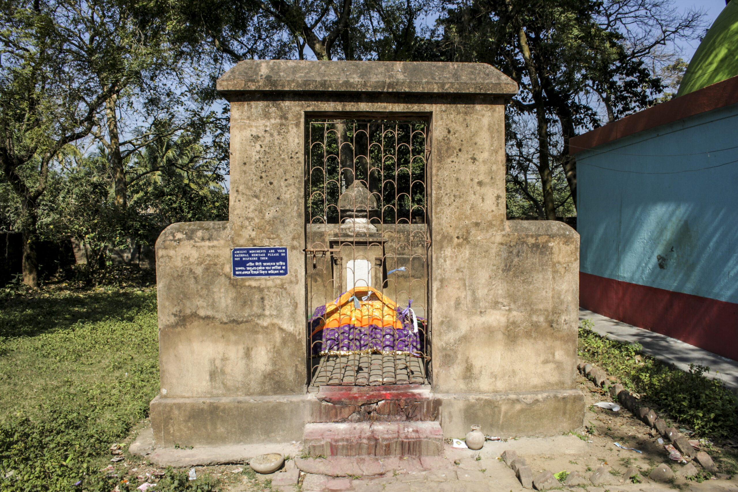
The tomb of Mir Madan, one of the most reliable commanders of Nawab Siraj-ud-Daula who died in the battle of Plassey on 23th June 1757 is situated in the compound of a Fakir Farid khan’s Dargah. Mir Madan worked in Dhaka under Hasanuddin Khan. Hasanuddin Khan was the nephew of Hosain Kuli khan who was deputy to Nawab Shahmat Jung, Nephew and son-in law to Nawab Aliverdi Khan of Bengal. Later Nawab Siraj brought him from Dhaka to Murshidabad and made him the commander-in-chief. He was given the title ‘Bakshi’. From there he never broke the faith of the Nawab till his death in the battle of Palashi.
Photo Gallery
The Ancient Mosque
- Location: Lat. 24⁰ 04’ 46” N.
Long. 88⁰ 14’ 32” E)
Locality- Faridpur
Dis- Murshidabad
Gazette Notification No- 83 dated the 12nd January, 1906
Brief Description
The mosque was built by Rafat Khan in 900 AH (1494-95 CE) during the reign of Sultan Alauddin Husain Shah (1494-1519 AD). The covered rectangular structure of this mosque, consisting of a single domed prayer chamber and a triple domed corridor is constructed entirely of brick. The hemispherical dome of the main prayer chamber fell down in the earthquake of 1897.
Photo Gallery
Tomb Of Azimunnessa Begum, Daughter Of Murshid Kuli Khan
- Location:
- Lat- 24.1987°N
- Long-88.2647°E
Locality-Azimnagar
Dis- Murshidabad
Gazette Notification No-
Brief Description
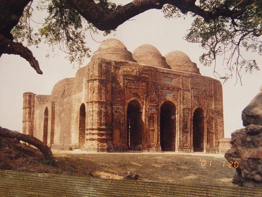
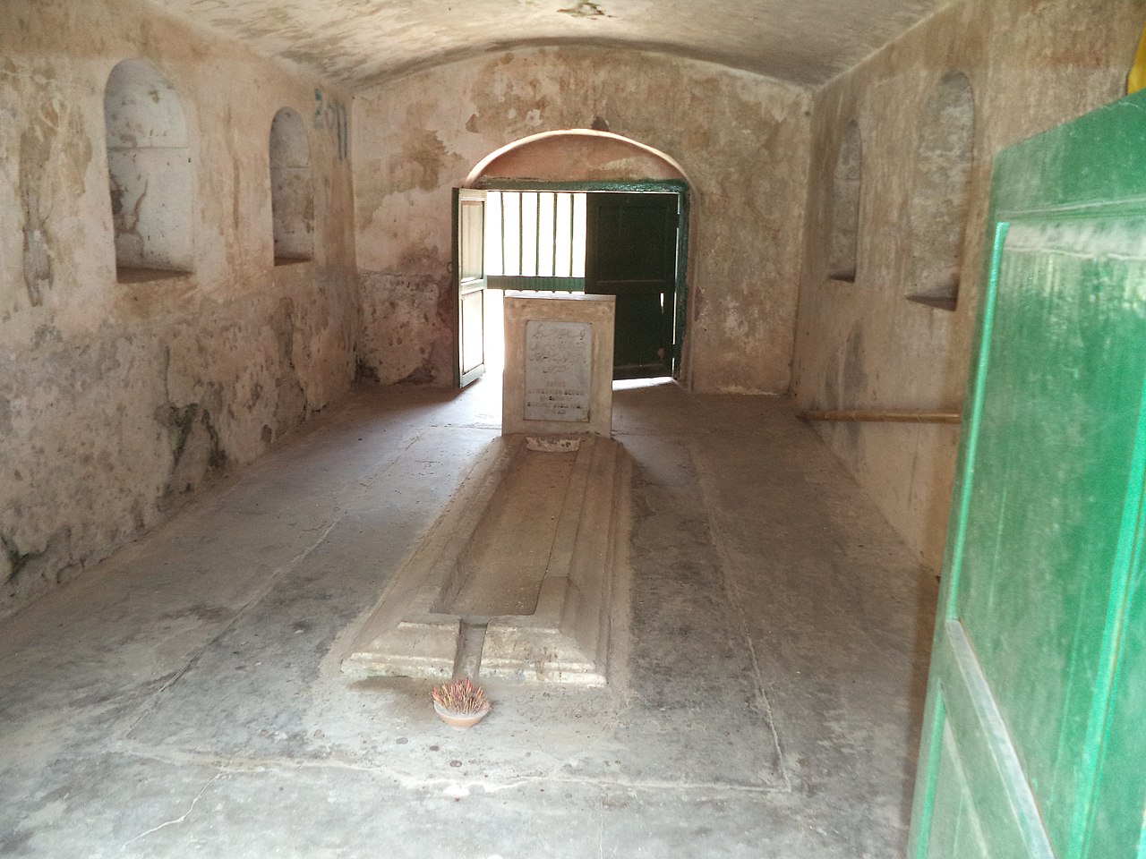
Azimunnessa Begum was Murshid Kuli Khan’s only daughter and wife of second Nawab of Murshidabad Suja-ud-din. According to an inscriptional slab embedded in the east entrance to the mosque, it was erected by the Begum. She died in 1734. Like her father, she is buried near the entrance to her mosque.
Photo Gallery
Yellow Mosque
- Location-
Lat. 24⁰ 11’ 12” N.
Long. 88⁰ 16’ 04” E
Locality- Killa Nizamat, Lalbagh
Dis- Murshidabad
Gazette Notification no. S.O. 555 (E) dated 14.05.2003
Brief Description
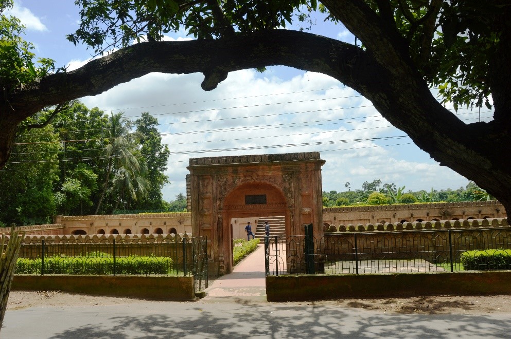
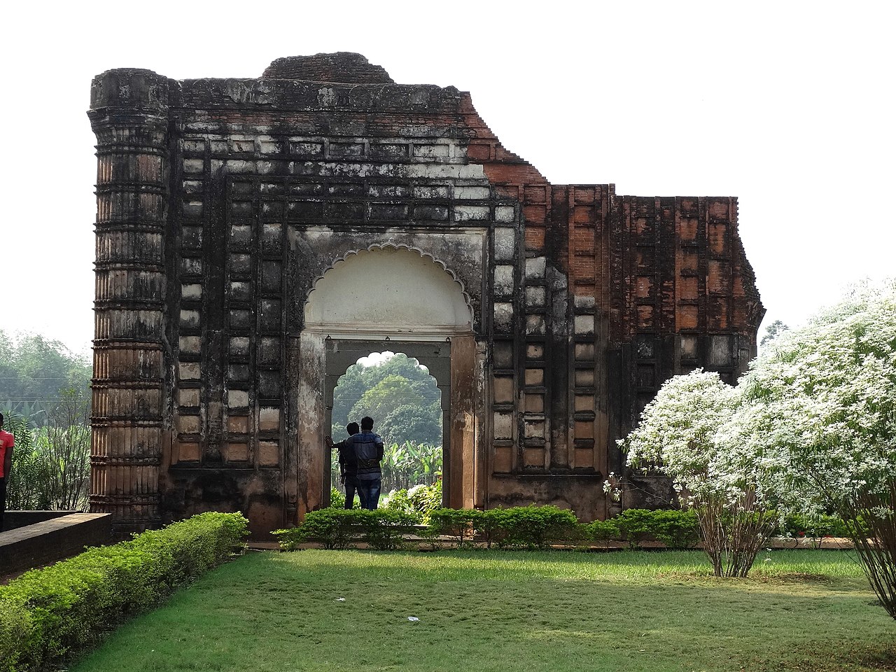
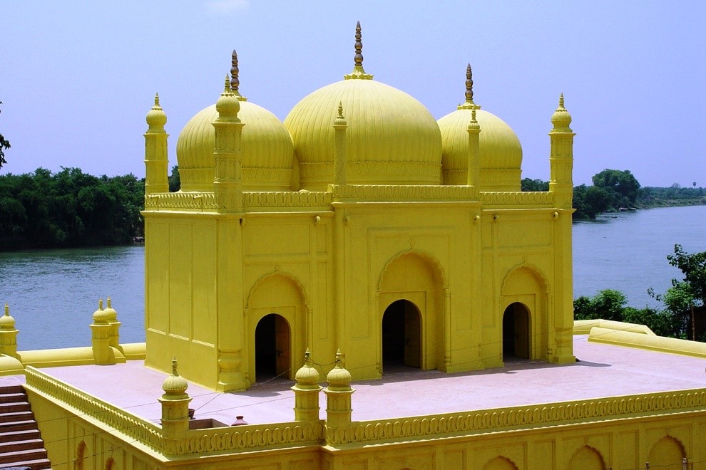
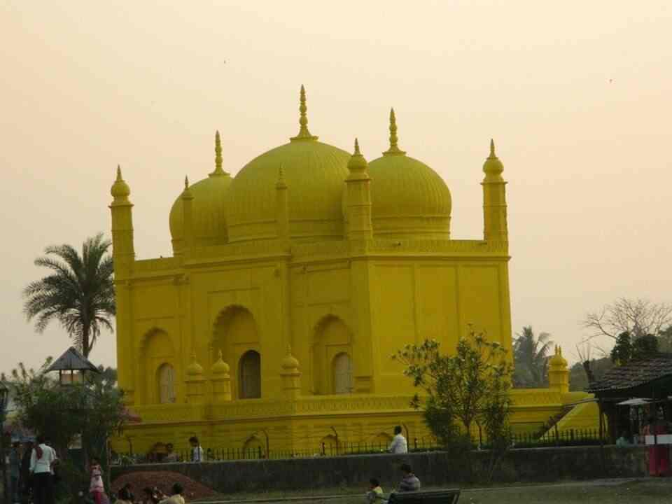
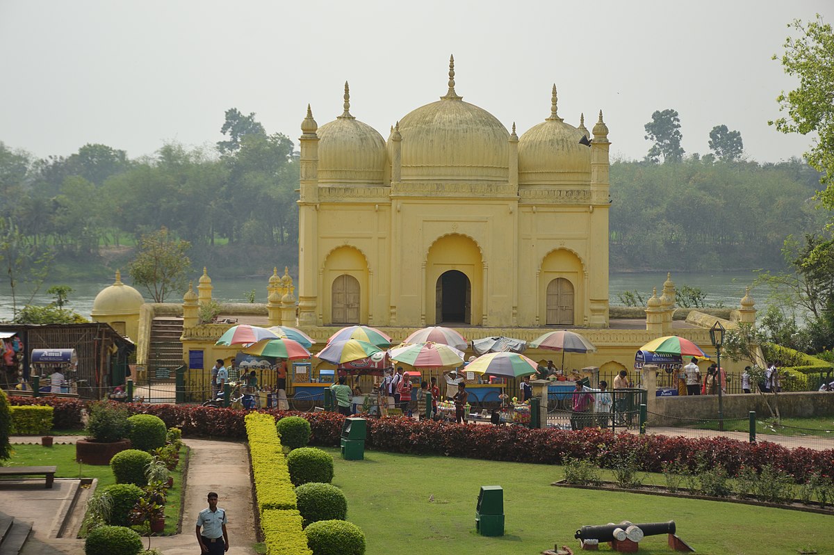
This mosque was constructed under the patronage of Siraj-ud-Dowla during 1738-57 CE. The mosque is topped with the three enormous ribbed domes. There are four minarets on the corner and two on the It is interned through three gates which are embellished with multifoil arch. Perhaps it was built for the beautification of the bank of Bhagirathi River.
Photo Gallery
White Mosque
- Location-
Lat. 24⁰ 11’ 12” N.
Long. 88⁰ 16’ 04” E
Locality- Killa Nizamat, Lalbagh
Dis- Murshidabad
Gazette Notification no. S.O. 555 (E) dated 14.05.2003
Brief Description
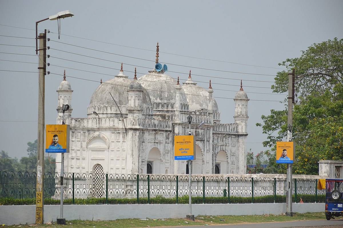
Three domed mosque bears the characteristics of the 18th century style. It is more likely to be built by Siraj-ud-Dowla. The east façade of central entrance is composed of carved pillars of black basalt.
Photo Gallery
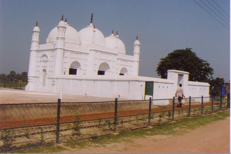
Nil Kuthi Mound
- Location- Long: 88°10’25” E, Latitude: 24°01’15” N
Locality- Chandpara
Dis- Murshidabad
Gazette Notification No. BG, 80-Mis, Dated-14.01.1916
Brief Description
Nilkuthi mound was named after the existence of Indigo factory during the British period. This mound was excavated from 6th December 2005 to April 2006 by the Archaeological Survey of India. On the basis of excavation, a general chronological span ranging from 2nd Century to 15th -16th Century has been exposed for the site. In the light of the material remains a three-fold cultural stratigraphy may be constructed.
Period 1- Second to the fifth century
Period II- Fifth-Sixth to the eleventh-twelfth Century
Period III- Fifteenth-Sixteenth Century
The first two cultural period has yielded material remains datable to the pre-Islamic period. Artifacts from period I include materials of the Kushana, Gupta and Post- Gupta periods. Profuse quantity of terracotta plaques depicting human figures, mostly female of divine and semi-divine characters, stylistic features indicate typical early historic affinity. Some female head figures have been specifically dated to Gupta period. A miniature stone image of Surya in low relief dated to CE 2nd -3rd Century was claimed to be the oldest image of the Sun-God from Bengal. Material culture of period II consists of fragmented Buddhist Sculpture in stone and an interesting miniature sculpture of Mahisasurmarddini dated to 7th CE, some inscribed terracotta seals containing personal names, beads and large quantity of pottery. The habitational character of the mound is indicated by remains of two terracotta wells.
Photo Gallery
Barkona Deul Mound, Panchthuppi
- Location- Long: 88°10’25” E,
Latitude: 24°01’15” N
Locality- Chandpara
Dis- Murshidabad
Gazette Notification No. BG, 80-Mis, Dated-14.01.1916
Brief Description
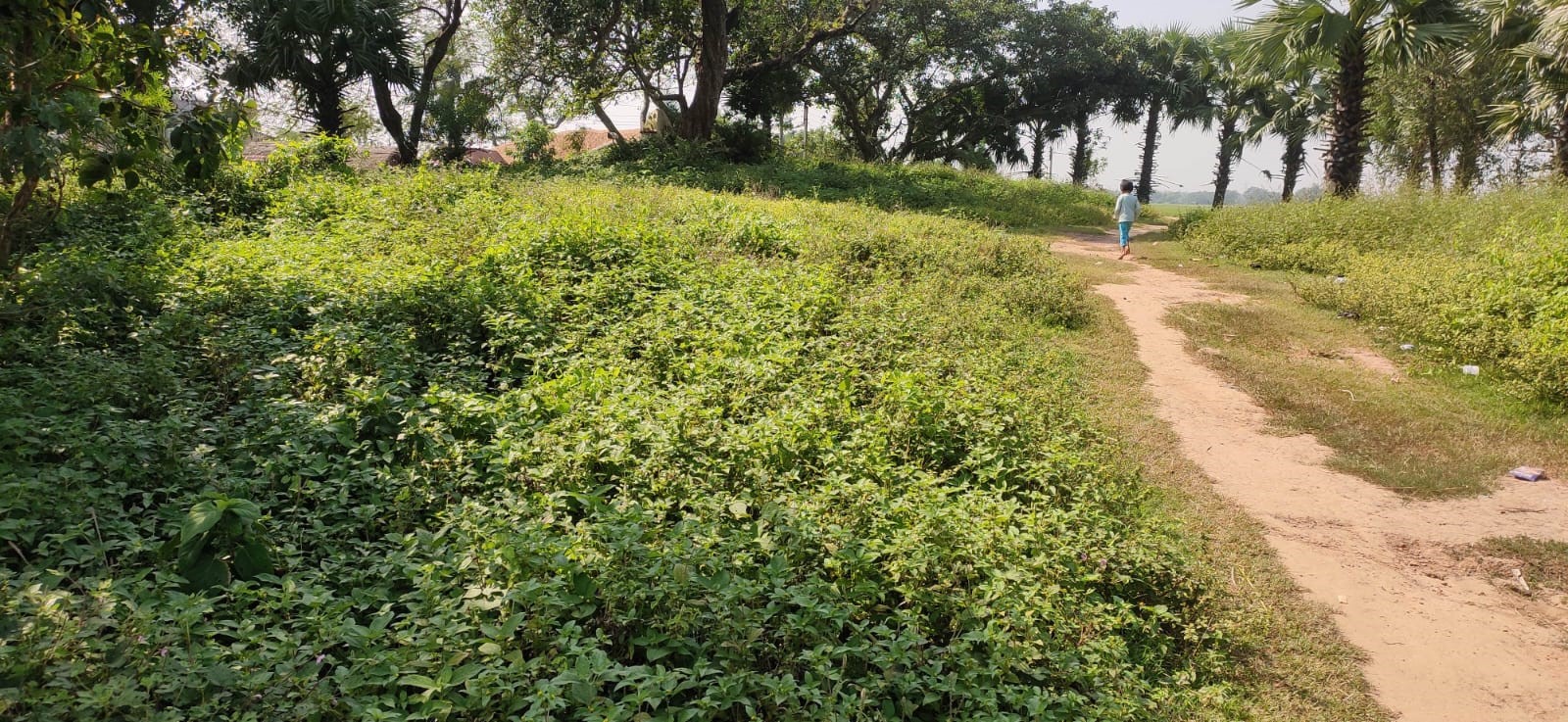
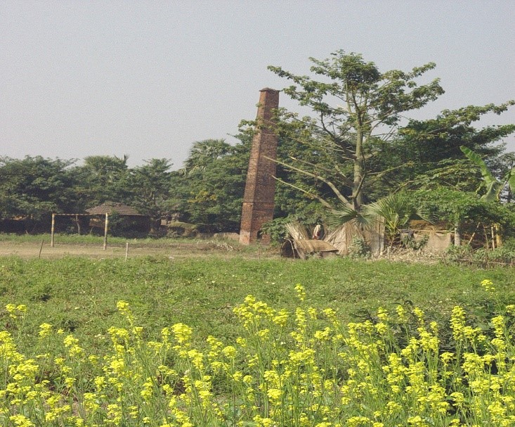
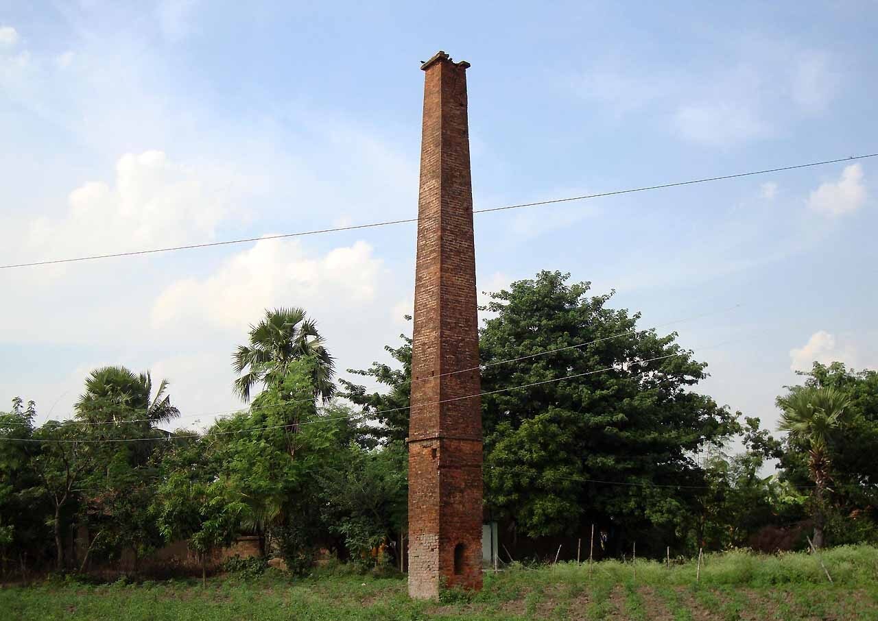
The village is said to derive its name from five (Panch) mounds (Stupa/Thupi). It is one of the possible groups of five Mounds indicating the remains of a Stupa as signified by the word ‘Panchthupi’- the name of the locality. The Mound is nearly 20 m. in diameter which contains the remains of an ancient structure. Some ruins are on its surface, possibly belonging to the Pala period.
Photo Gallery